Configure Now
Items in Your Cart0
0Items in Your Cart
Start building your packageShop Now


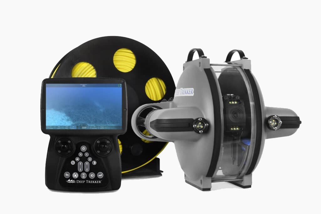
The SeaTrac Ultra Short Baseline Locating system enables positional awareness of your ROV, set waypoints, and program autonomous routes. When piloting an ROV in open water missions, understanding where you are or where you have been can be challenging. Without the ability to utilized GPS underwater, ROVs rely on the use of this sound technology for navigation and locating.
Error adding item to quote
Added to quote


Track ROV position underwater

On-screen integration


1 km range
Bridge integrated Blueprint Subsea SeaTrac Ultra Short Base Line (USBL) Positioning System for tracking ROVs
With Deep Trekker's Mission Planner you can create waypoints at pre-defined locations or import a spreadsheet and have these coordinates or geo locations displayed on the map at all times.
Mission planning can also help you keep track of locations you want to return to. Simply create a waypoint or drop one using the program button while piloting to get added to the mission file.
X150 USBL Beacon
X010 Modem Beacon
20m X150 Deck Cable
USB/Power Splitter Cable
1m X010 Diagnostic Cable
1m X010 Cable Whip
X150 Pole Mounting Bracket
USB GPS Receiver
Universal AC-to-DC 24V Power Supply
SeaTrac PinPoint Windows Software and Electronic Manual
Reset Magnet
Peli™ Transit Case
| Length | 106mm (4.2”) exc con - 134mm (5.3”) inc con |
|---|---|
| Weight | 690g in air - 500g in water |
| Diameter | 54mm body, 59mm cage |
| Depth Rating | 2000m |
| Construction | 316 Stainless Steel and Black ABS plastic |
| Operating Temp Range | -5°C to +40°C (23°F to 104°F) |
| Ranging | Yes |
|---|---|
| Acoustic Range | 1km radius horizontal, 1km vertical (hemispherical) |
| Beacon Velocity | Active Doppler compensation, up to 15kts (28kph) |
| Range Resolution | ±0.1m (dependant on provided VOS accuracy |
| Velocity-of-Sound Rang | 1300ms to 1700ms (can auto-compute from water temp & depth) |

We use cookies to collect information about how you interact with our website to improve and customize your experience. To find out more about the cookies we use, see our Privacy Policy.